|

Admiral Park travel plans
Living Streets' Tom Le
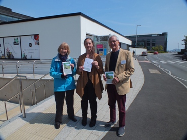
Pelley and Pat Wisher joined Nicki Bessin at Admiral Park to launch their Walking month campaign on Friday 29th April.
The Guernsey Press and Bailiwick Express featured the campaign on Saturday. Below you can download the two maps.
click here to download a map
click here to download the 2nd map

Admiral Park travel plans
Living Streets has been working
with Nicki Bessin (Travel Plan Co-ordinator) to provide maps of routes to the new developments - Julias Baer and the Premier
Inn. We are collaborating during May Walking Month to encourage more active travel. An A1 map showing a one mile
distance from Admiral Park has been kindly given to us by Digimap and Living Streets has provided two leaflets showing
the best/safest walking routes - one from Town and one using our Baubigny Schools pathway from St. Sampson. (pictured)

|
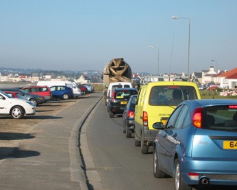
| Bulwer Avenue traffic morning rush hour |
Travel Plans - what are they?
In the
UK several thousand organisations have developed (green) travel plans - packages of measures to reduce car driving (particularly
sole occupancy), and support alternatives. The trick is to find the right mix of measures to suit individual circumstances.
The Department for Transport has undertaken a research study, featuring 20 UK organisations, and has found that as
a result of their travel planning, organsiations achieved between 15 and 18% reduction in the proportion of commuter journeys
being made by car. These employers included hospitals, local councils, schools and colleges and both major and small
companies.
Among the measures used to reduce car dependence were: developing a car sharing data base, encouraging
walking and cycling, working with public transport operators to negotiate changes more suited to staff, restricing on-site
car parking spaces, providing financial incentives to those who arrive without a car, giving preferential parking to car sharers
and supporting alternative work practices which reduce the need to travel.
A useful website: www.bettertransport.org.uk

|
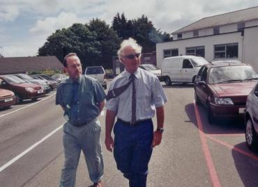
| Anthea Nicholson (DfT), John Elliott (Pfizer), Richard Armitage, Stephen Joseph OBE (Transport 2000) |
Travel Plans Conference 2003
In October
2003 Living Streets (formerly STEPS) organised a conference on Travel Plans, bringing over from the UK four key speakers.
The conference was financially supported by the Traffic Committee and the Board of Health. Over 50 delegates took part
from all walks of Guernsey life.
Since then Living Streets has been trying to encourage businesses and the States
of Guernsey to develop workplace travel plans.
Royal Bank of Canada Wellness Day 2011
Living
Streets provided information to the Royal Bank of Canada's Wellness Day in January. The company was looking to promote
sustainable transport to their staff and we were asked to give them some information about walking to work.
Guernsey
is such a small island that it should be possible for many staff to walk to work. With the help of Digimap we produced
maps showing a one mile and two mile walking distance from RBC's offices in both Guernsey and Jersey. One mile is
about a 20 minute walk.
We also provided an A4 sheet with information about the benefits of walking and how to
keep safe on the roads at night.

|
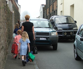
| Cordier Hill children walking home from school |
School Travel Plans
Over the years we have
worked with schools to help them develop School Travel Plans (STP) in order to reduce congestion around the school gate.
La Houguette School has been successful in encouraging more children to use the school bus. La Houguette
has a wide catchment area from the Forest, through Torteval and St. Pierre du Bois and St. Saviour. Living Streets helped
the school analyse a questionnaire sent to parents which asked how many would be prepared to use the school buses. We
then plotted the location of those interested on a digimap. This information was then used to re-vamp the school bus
service.
Living Streets has also helped Capelles, St. Martin and Castel Primary schools and St. Mary and St.
Michael.
|


